
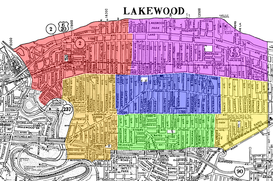
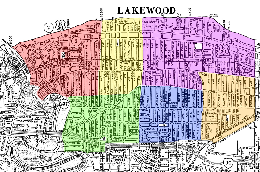
At last night’s school board meeting, Dr. P. Joseph Madak shared with the audience that additional Phase III information has been shared with the Board. That information was simply two maps showing what the school district configuration would look like if Lincoln closed today and what the school district configuration would look like if Grant closed today. No additional information was shared with the Board.
These maps are drawn in such a way that each school has relatively the same amount of students in each building. These maps also have dots that show where every elementary school children resides.
Immediately after the meeting, I gathered the parents in attendance, shared with the attendees the actual maps provided to the Board, and explained that the only information shared with the Board was the two maps.
Nonetheless, I do believe that the maps are worth reviewing so I have taken the liberty of removing student residencies and highlighting the various school regions on separate maps. These are not the same maps given to the Board, but the school regions are the same.
The map representing what the school district configuration would look like if Lincoln closed today, is as follows below:
overlays ©2010 AGS
------------------------------------------------------------------------------------------------------------------------------------------------
The map representing what the school district configuration would look like if Grant closed today, is as follows below:
overlays ©2010 AGS
Matt